Introduction
Obubu Tea Farms manages many tea fields spread across the hills of Wazuka in Kyoto Prefecture, and the number grows each year as Akky-san acquires more. Each field has its own unique character, with different cultivars, cultivation methods, and personalities.
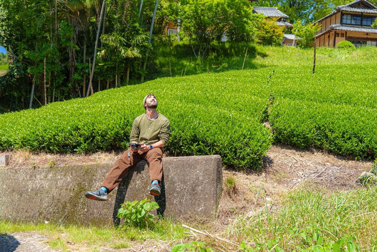
My name is Kenji, intern #218. I’m generally curious about all things tea, and I spent my first few weeks at Obubu digging through archives and asking a lot of questions. I immediately was very curious about the many fields Obubu has and wanted to learn everything I could about them, but a lot of that knowledge lived in scattered spreadsheets, staff memory, and photos across Google Drive. That’s when I came up with this project to consolidate it all so that future interns, assistant managers, and staff have one centralized resource with supporting visuals. I have a background in photography and data analytics, so when I noticed the gap in centralized field information, this project felt like a natural fit.
Over the course of my internship, I took on two tasks, rephotographing as many of Obubu’s managed fields as possible using drone photography, and building a field database that brings key information together in one place.
The Gap
Previous interns had already captured aerial photos of the fields, but when I went through the archives I noticed many could use a refresh. Some images had heavy shadow coverage, some fields had been recently deep trimmed or were photographed during early growth periods, and others were simply outdated. A few newer fields had no photos at all. The biggest archive came from Milan U. (Intern #205), whose project from last summer became the foundation I built from.
The field information had a similar problem. Details like cultivar names, locations, produced teas, and elevation data existed, but they were spread across multiple sources with no single place to look everything up at once. Early on I noticed this gap when answering guest questions, being onboarded as a new intern, or just trying to orient myself before heading out to a field. A centralized information source seemed like something that would pay forward for a long time.
The project was a straightforward response to that. Provide a one stop shop for everything about each field, backed by fresh visuals.
The Goal
The project had two main goals plus a stretch goal.
The first was to capture updated aerial photographs of all 29 of Obubu’s currently managed tea fields.
The second was to organize a field database in Google Sheets, consolidating each field’s English and Japanese names, cultivar information, GPS coordinates, size, elevation, produced teas, and links to aerial imagery, designed to be a document that grows as the farm does.
A third goal, if time allowed, was to update Obubu’s Google My Maps, originally created by previous intern Yanis S. (#143), with the new imagery and field data and to build an interactive map that guests could use to learn about Obubu’s fields and teas that are produced there.
Building the Database
I started with the database, working to get a full and up to date list of all managed fields before I started shooting.
I went through all existing imagery first and ranked each field by how much it needed a reshoot. I ended up with around ten fields that clearly needed new photos (out of date, no coverage, or heavy shading), nine that could benefit from a reshoot but weren’t urgent, and ten that were already great photos.
With the list complete, I started building out the data columns, choosing data points that I felt would be beneficial for a new intern or assistant manager trying to quickly understand a field. I started with field names in English and Japanese, cultivar names, GPS coordinates, and links to Yanis’ Google My Maps project.
During a tea tour in April, a guest asked me about the size and elevation of some of our fields, which gave me the idea to add surface area and maximum and minimum elevation data. I calculated these values using Google Earth. Then as the harvest season picked up in late April, I added each field’s 2026 spring harvest teas and cultivation methods (shaded or unshaded.) The produced teas change year to year, but having a 2026 foundation gives future interns a strong starting point.
Here are some fun facts about Obubu Tea Farm’s fields:
Total size: The farm spans roughly 43,000m² across 29 managed fields, that’s 4.3 hectares or about 10.6 acres of tea growing real estate.
Elevation: There’s a 426m elevation difference between the highest and lowest fields. Koshigoe reigns at the top with views from about 479m, while Kamo sits down at around 53m.
Field rankings: Aoimori is the largest field at 10,700m², nearly two and a half times bigger than second place. Somada is second at 4,000m² and Tenku third at 3,400m².
As a bonus, to satisfy my own curiosity, right before the project deadline, I calculated the total surface area of each cultivar across all fields. From this I learned that Yabukita is our largest cultivar by surface area at around 2.4 hecters, with Zairai second at 0.7 hecters , and Okumidori third at 0.4 hecters.
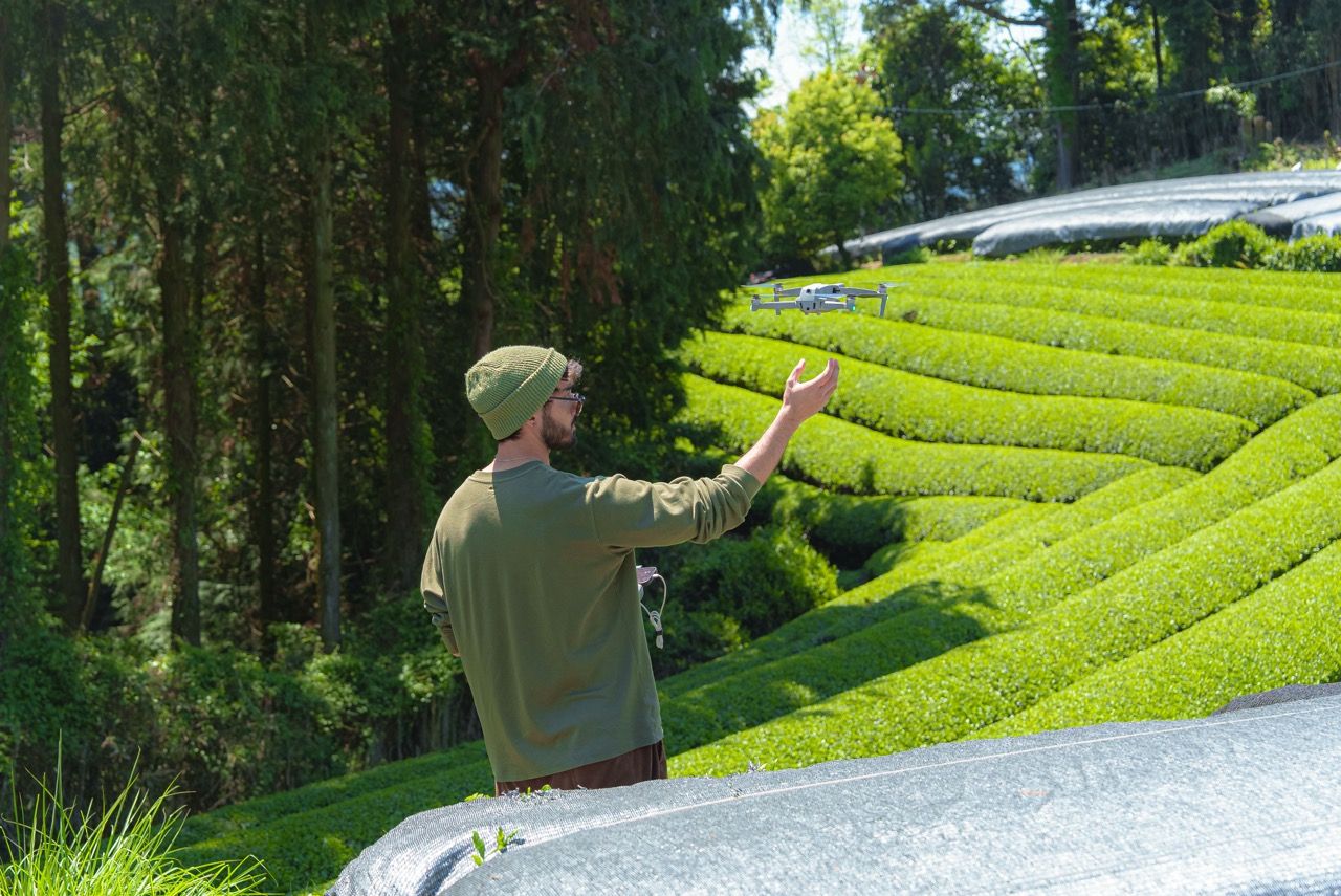
Drone Photography
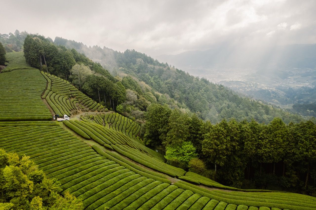
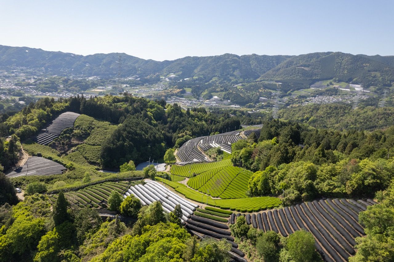
The photography started with an early morning excursion in April with Katrina and Maren up to Tenku to watch the sunrise over tea. I brought the drone and captured a full top down image of the field along with some of the surrounding scenery.
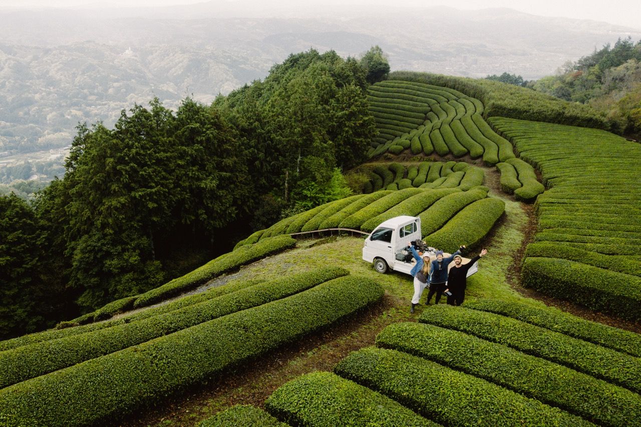
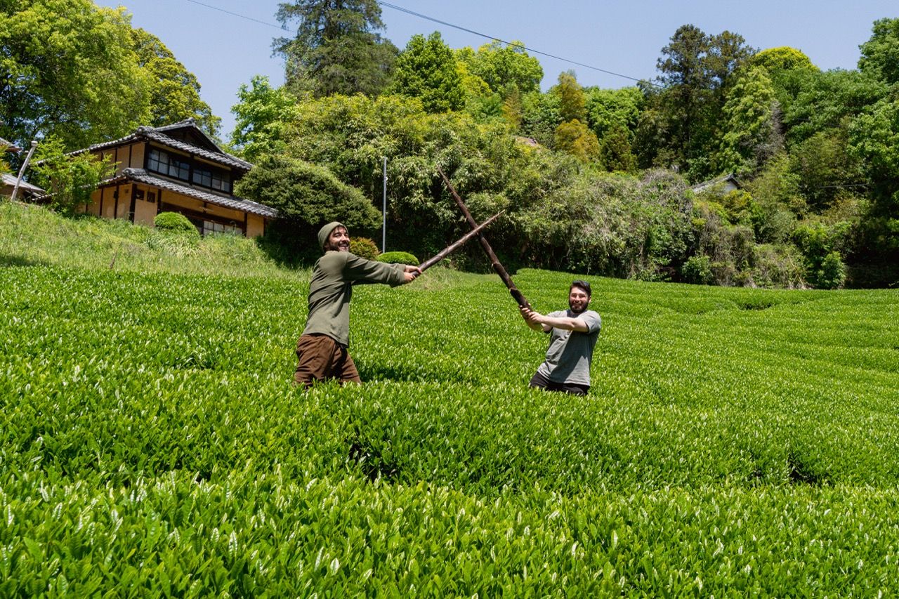
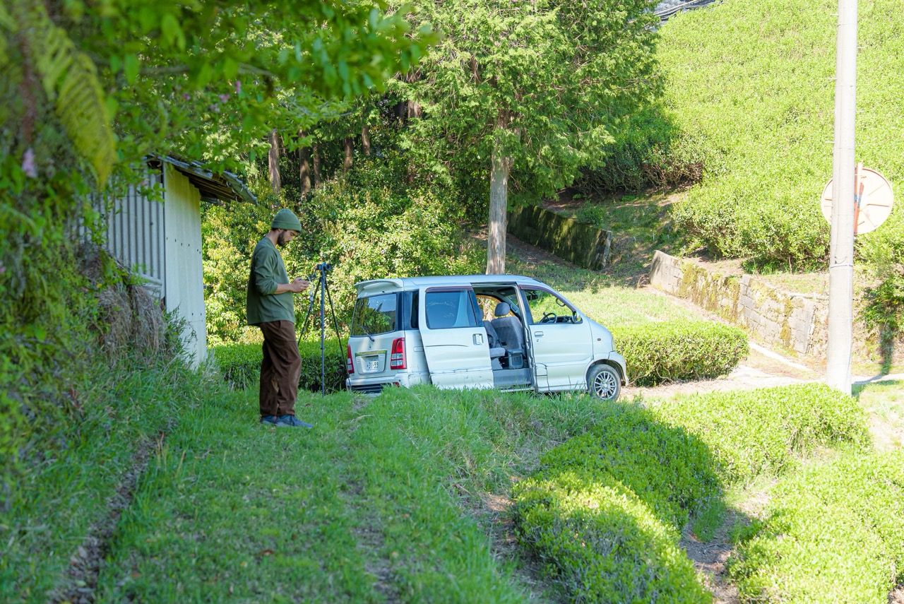
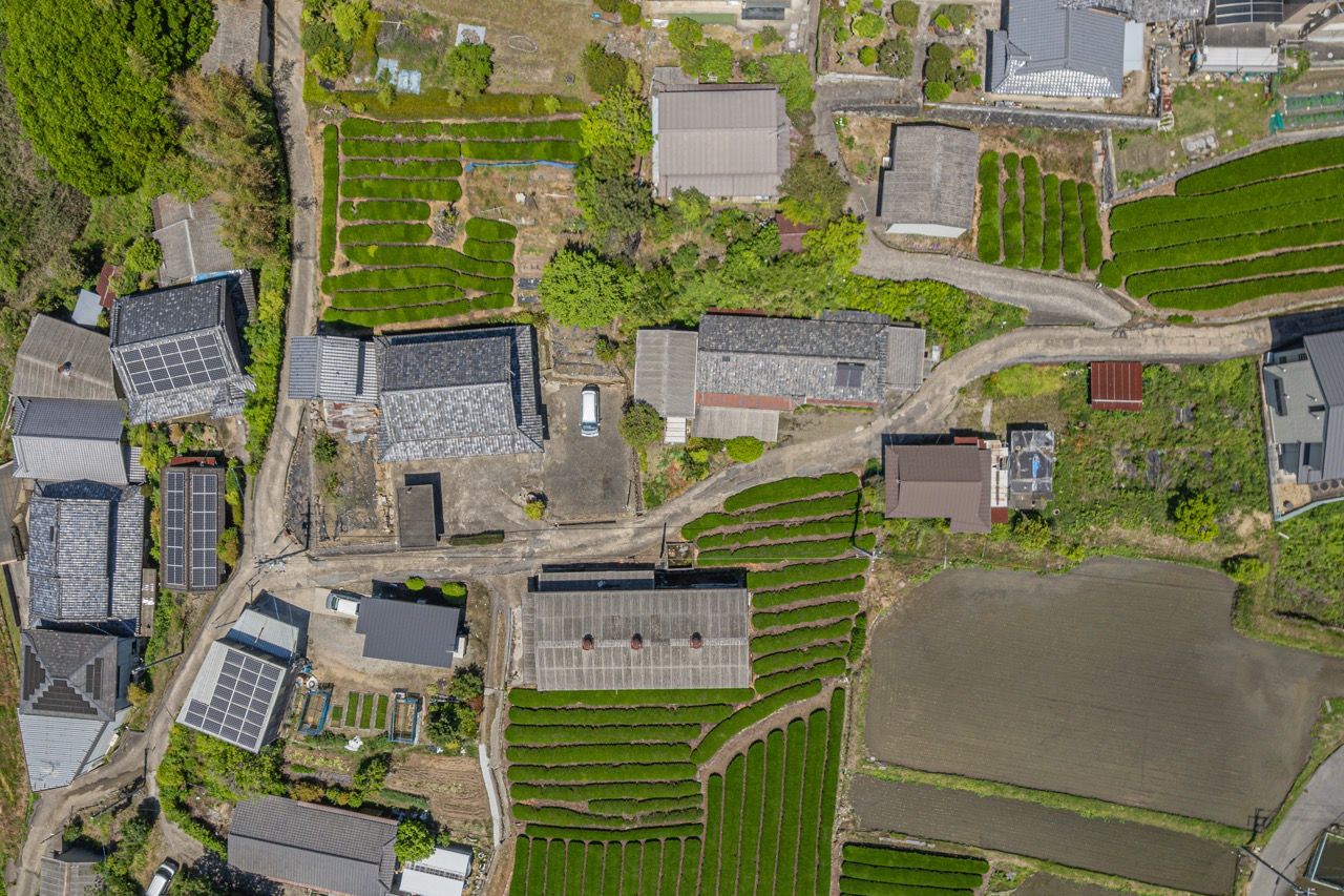
The main photography push came in early May, when George and I spent a full day driving around Wazuka together. We covered about half the fields that needed shooting. By this time many fields where we produce Kabuse, Gyokuro, and Tencha were shaded so those had to wait til after harvest. It was a wonderful day. I got to hear about George’s journey in tea, his time as an intern turned staff member, and the broader history of Obubu. We shared a few cups of tea together and even had a bamboo sword fight in the field! The fields we covered that day were Michi Nashi, Monzen Horike, Monzen Sugimoto, Monzen, Fire Station, Ie Yoko, Ie Ura, Ie Mae, Kouminkan, Petto, and the most recently aquired nameless new field.

The Result
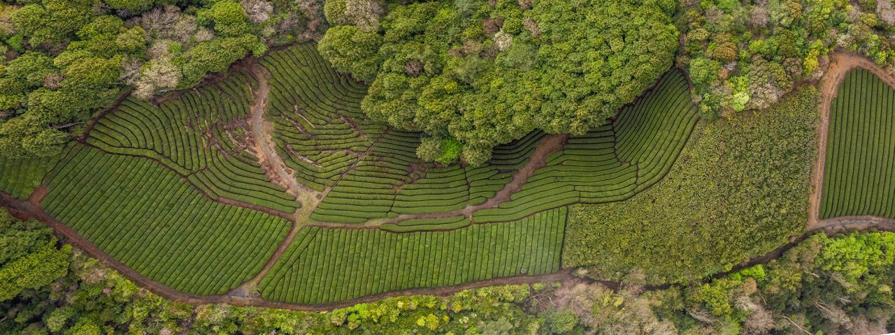
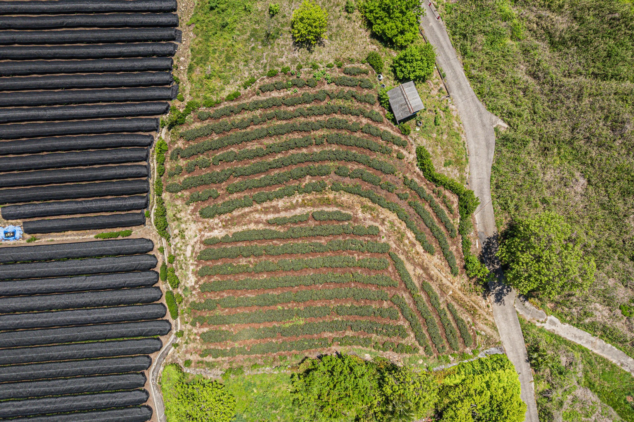
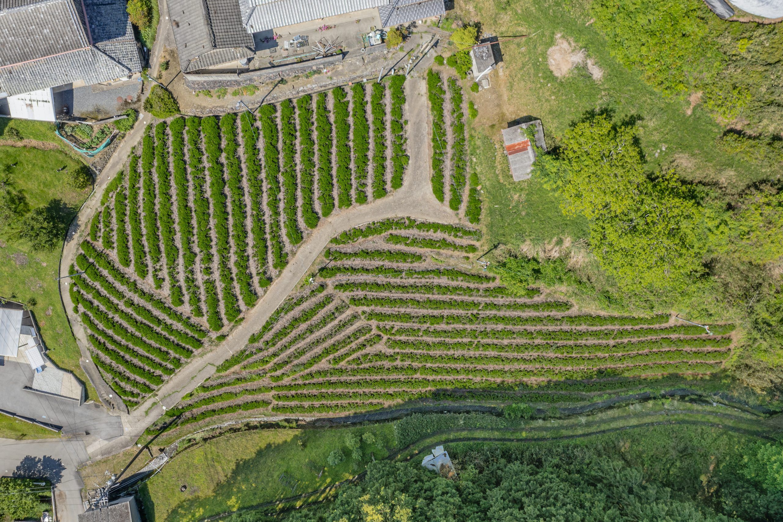
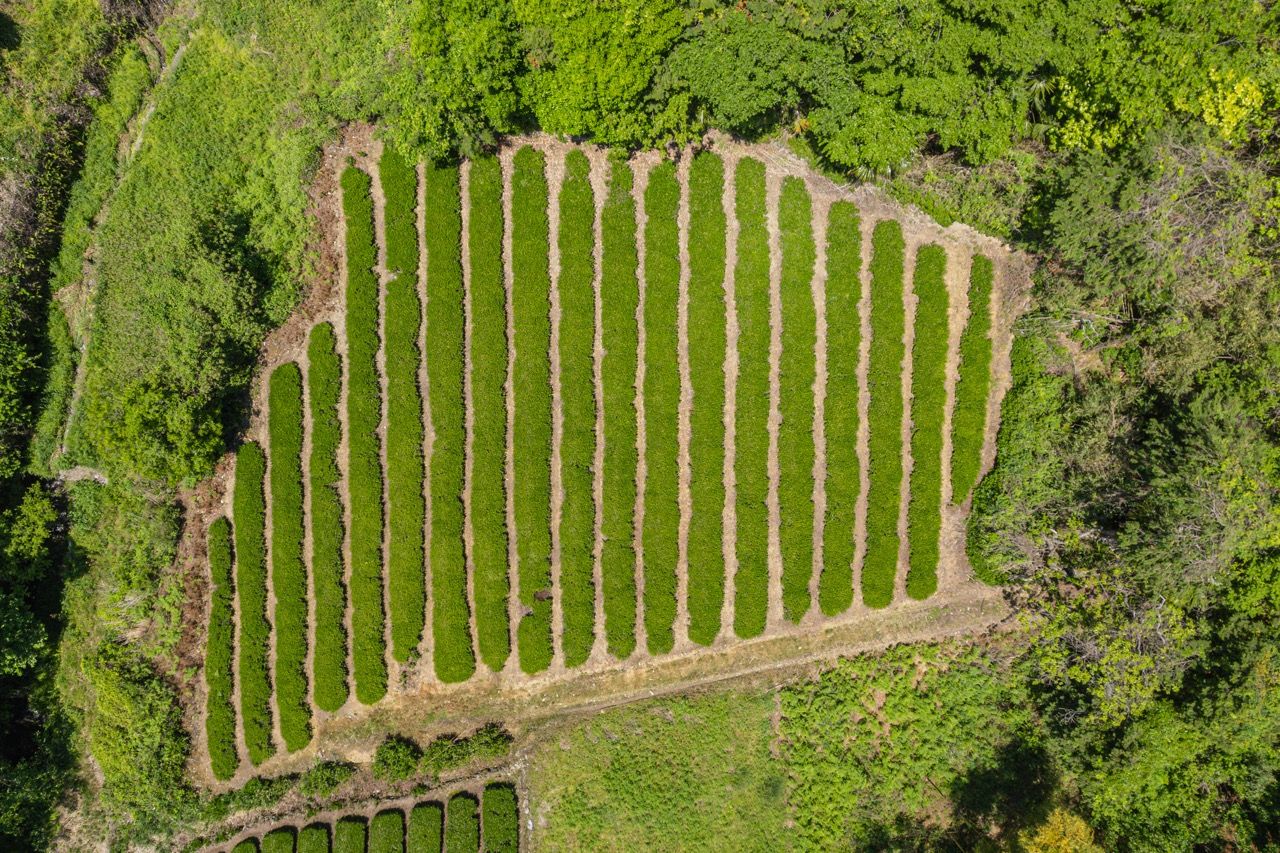
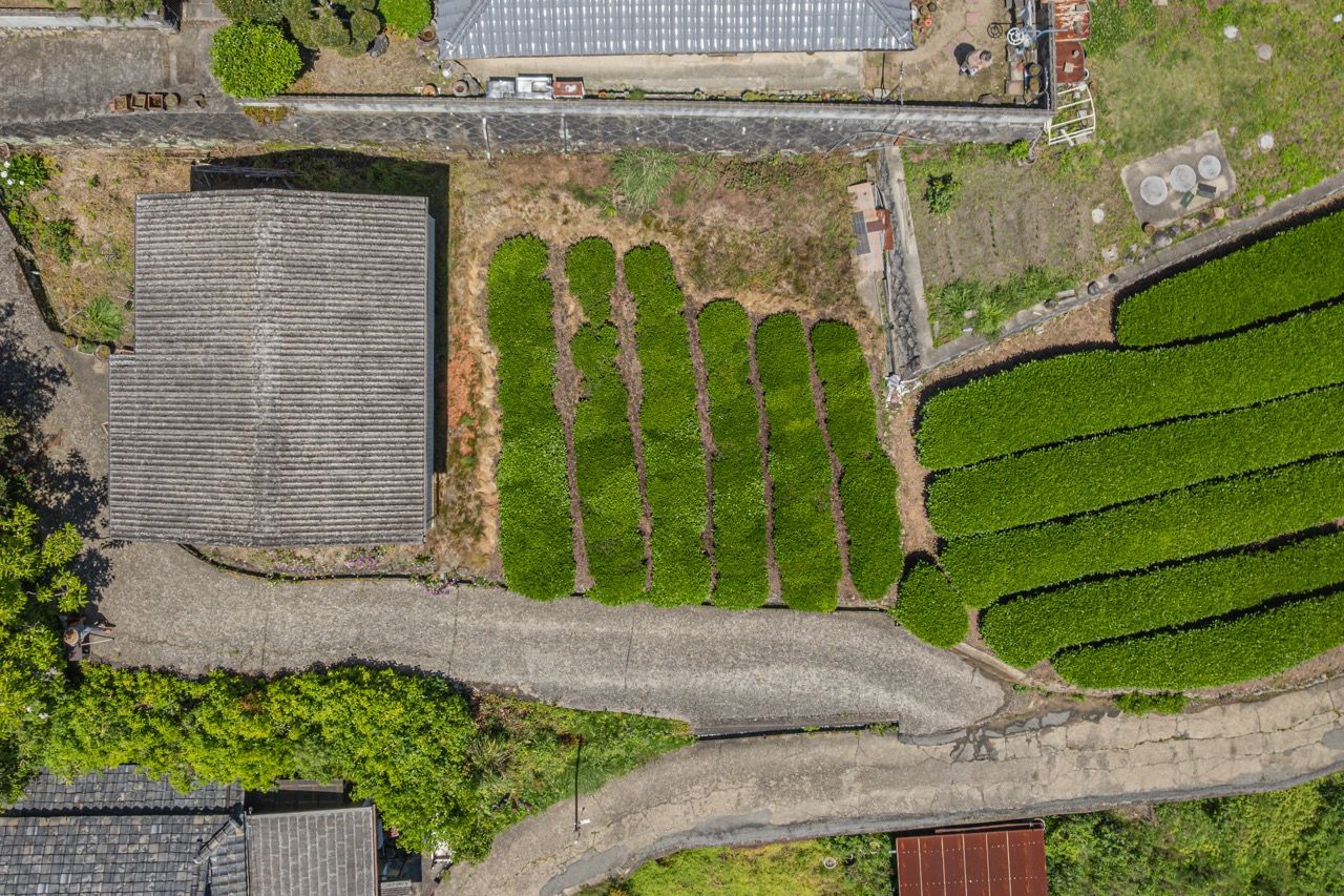
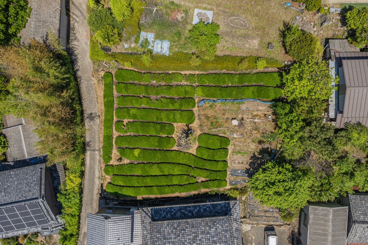
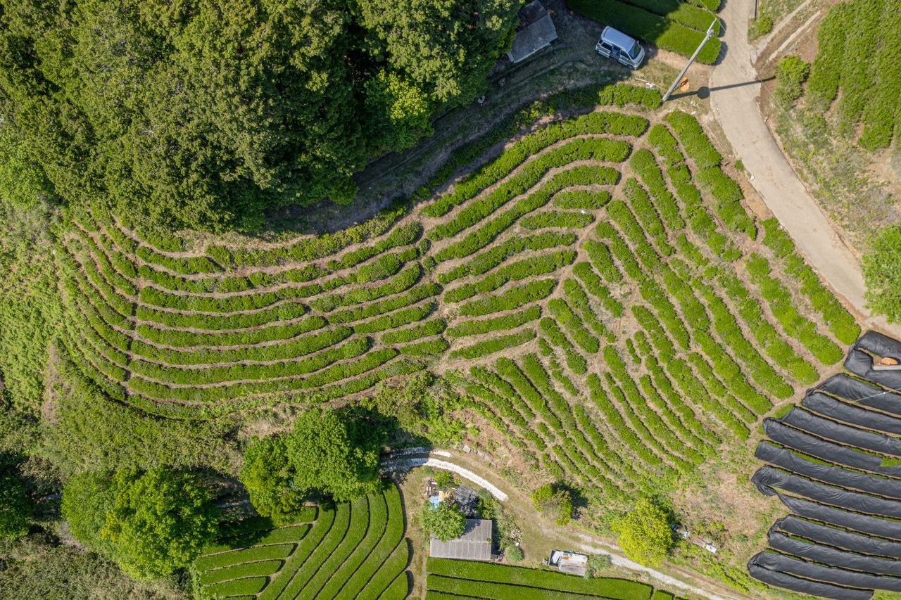
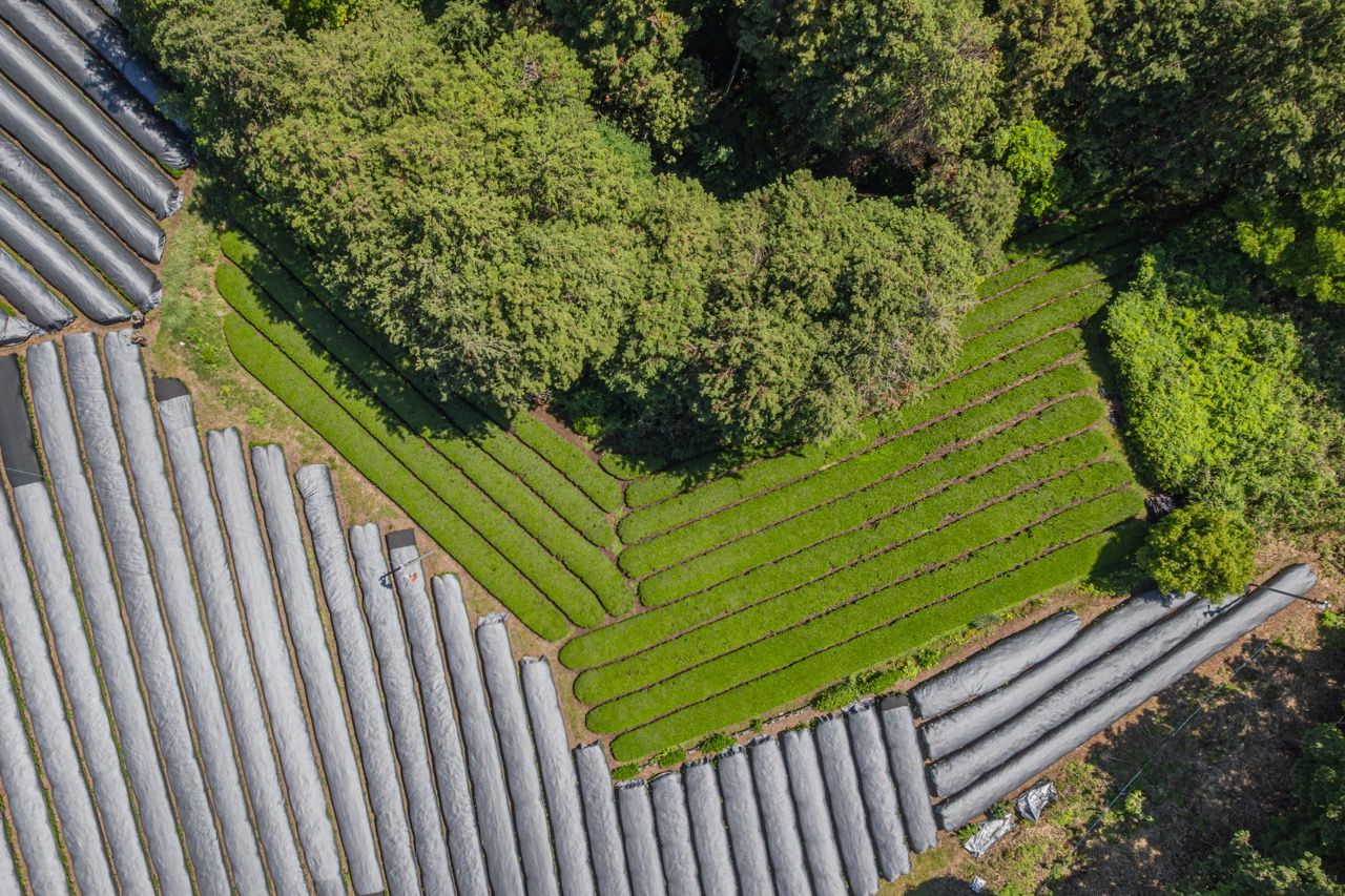
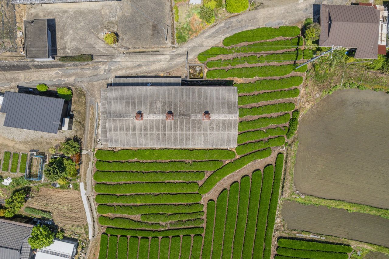
I finished a complete database of all 29 currently managed fields, with information on cultivar, field size, elevation, 2026 produced teas, geo coordinates and links to top down images for each. In total, I was able to capture updated images for 15 of the 19 fields that needed or could use reshoots, along with supporting scenic shots that are now some of my favorite drone photos I have ever taken. Wazuka’s tea fields are just so beautiful! The remaining 4 fields never got unshaded before my internship wrapped up.
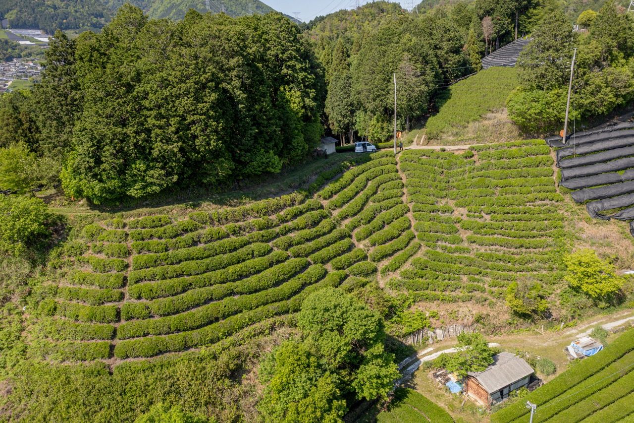
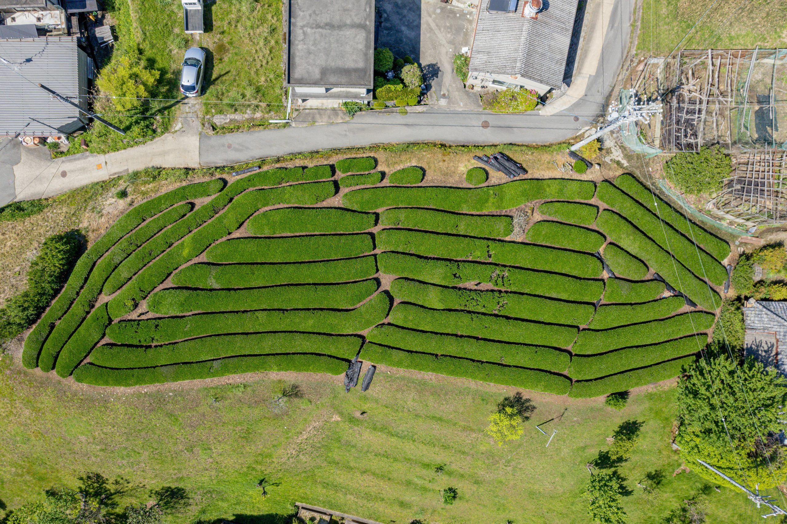
Here are some of the top down photos I captured for this project.
Reflection
Sharing the database with assistant managers and staff, as it came together, was very encouraging as many found it genuinely useful, both as a reference for guest questions and as a tool for planning farm days. I personally used it regularly during spring harvest to quickly look up cultivar details and find directions to the fields. My fellow interns also enjoyed being able to see aerial photos of fields they never got a chance to work on.
My original vision for this project extended a bit further with an interactive web map of Wazuka where users could click on each field to learn about its cultivars, unique details, and the teas it produces, with links to purchase them. With how busy spring harvest got, I unfortunately did not have the time to build that, but I hope a future intern will. Someone, onegaishimasu!
This project gave me a chance to visit many of Obubu’s fields that I never would have reached through farm work alone, to stand in them, see them from above, and appreciate the environment we’re all working within. That experience was a gift.
Thank you to George, Katrina, Miwako-san, Garance, and everyone who helped make this project possible!